Файл:Entrance to monument and visitor center. View NE. - Scotts Bluff Summit Road, Gering, Scotts Bluff County, NE HAER NE-11-3.tif
Перейти к навигации
Перейти к поиску

Размер этого JPG-превью для исходного TIF-файла: 733 × 599 пкс. Другие разрешения: 294 × 240 пкс | 587 × 480 пкс | 939 × 768 пкс | 1253 × 1024 пкс | 2505 × 2048 пкс | 5181 × 4236 пкс.
Исходный файл (5181 × 4236 пкс, размер файла: 20,93 МБ, MIME-тип: image/tiff)
Этот файл находится на Викискладе. Сведения о нём показаны ниже.
Викисклад — централизованное хранилище для свободных файлов, используемых в проектах Викимедиа.
|
Краткое описание
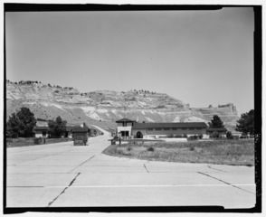
| Entrance to monument and visitor center. View NE. - Scotts Bluff Summit Road, Gering, Scotts Bluff County, NE | ||||
|---|---|---|---|---|
| Фотограф |
Related names:
|
|||
| Название |
Entrance to monument and visitor center. View NE. - Scotts Bluff Summit Road, Gering, Scotts Bluff County, NE |
|||
| Изображённое место | Nebraska; Scotts Bluff County; Gering | |||
| Дата | Documentation compiled after 1968 | |||
| Размеры | 4 x 5 in. | |||
| Текущее местонахождение |
Library of Congress Prints and Photographs Division Washington, D.C. 20540 USA http://hdl.loc.gov/loc.pnp/pp.print |
|||
| Инвентарный номер |
HAER NE-11-3 |
|||
| Дополнительная информация |
|
|||
| Примечания |
|
|||
| Ссылки |
|
|||
| Источник | https://www.loc.gov/pictures/item/ne0103.photos.198565p | |||
| Права (Повторное использование этого файла) |
|
|||

| Местоположение объекта | | Это и другие изображения по их местоположению на OpenStreetMap |
|---|
История файла
Нажмите на дату/время, чтобы посмотреть файл, который был загружен в тот момент.
| Дата/время | Миниатюра | Размеры | Участник | Примечание | |
|---|---|---|---|---|---|
| текущий | 02:40, 29 июля 2014 |  | 5181 × 4236 (20,93 МБ) | Fæ | GWToolset: Creating mediafile for Fæ. HABS 24 July 2014 (2001:2300) |
Использование файла
Нет страниц, использующих этот файл.