Файл:Gulf of Venezuela (MODIS 2016-02-04).jpg

Исходный файл (2116 × 1552 пкс, размер файла: 546 КБ, MIME-тип: image/jpeg)
Этот файл находится на Викискладе. Сведения о нём показаны ниже.
Викисклад — централизованное хранилище для свободных файлов, используемых в проектах Викимедиа.
|
.jpg?uselang=ru)
Краткое описание
| Описание |
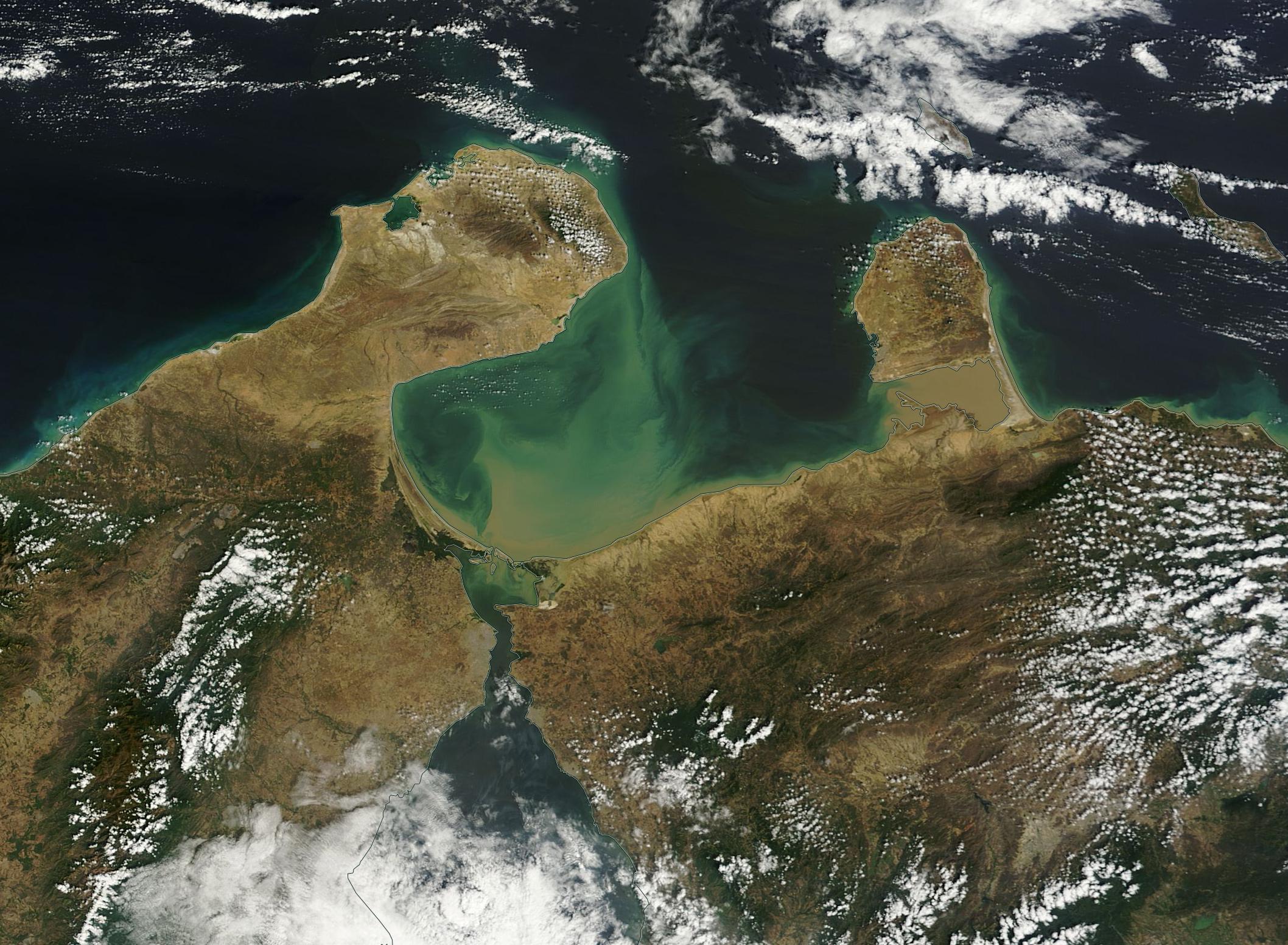
English: The Gulf of Venezuela is a kidney-shaped embayment sitting at the northwestern tip of South America, separating the Guajira Peninsula in Colombia in the west and the Paraguan� Peninsula of Venezuela in the east. To the north lies the Caribbean Sea, which brings saline water into the embayment, while to the south a 54 km (33.5 mi) channel, the Tablazo Strait, connects the Gulf to the brackish Lake Maracaibo. Also known as the Gulf of Coquibacoa or Gulf of Coquivacoa, the delineation between what is owned by Colombia and what waters belong to Venezuela is in dispute by the two countries.
Lake Maracaibo receives freshwater inflow from many rivers, including the large Catatumbo River located near the southern end of the lake. In turn, the lake water flows into the Gulf of Venezuela, often carrying a heavy load of sediment. Where the Catatumbo meets Lake Maracaibo, environmental conditions are ripe for the production of large quantities of ozone � and this ozone sparks remarkable � and frequent � shows of lightning, which can light up the skies for many hours each evening for 160 days or more a year. On January 31, 2015 the Moderate Resolution Imaging Spectroradiometer (MODIS) aboard NASA�s Terra satellite acquired this true-color image of the Gulf of Venezuela. In this image, tan sediment pours into the Gulf of Venezuela from the Tablazo Strait. The sediment is tan as it floats near the surface of the water, but as it sinks lower its reflective properties change and the color appears more greenish. Heavy sediment, which appears a muddy brown, floats between the Paraguan� Peninsula and mainland Venezuela. In the far south of the image, clouds lie over Lake Maracaibo, not far from the inflow of Catatumbo River � perhaps building up for another evening lightning show. |
||
| Дата | Снято: 31 января 2016 | ||
| Источник |
Gulf of Venezuela (direct link)
|
||
| Автор | Jeff Schmaltz, MODIS Land Rapid Response Team, NASA GSFC |
| This media is a product of the Terra mission Credit and attribution belongs to the mission team, if not already specified in the "author" row |
Лицензирование
| Этот файл находится в общественном достоянии (англ. public domain), так как он был создан NASA (Национальным управлением по аэронавтике и исследованию космического пространства). Политика авторского права NASA гласит, что «Материал NASA не защищается авторским правом, если не указано иное». (См. Template:PD-USGov, страницу политики авторского права NASA или политику использования изображений JPL.) | ||
 |
Предупреждения:
|
История файла
Нажмите на дату/время, чтобы посмотреть файл, который был загружен в тот момент.
| Дата/время | Миниатюра | Размеры | Участник | Примечание | |
|---|---|---|---|---|---|
| текущий | 19:47, 15 февраля 2024 | | 2116 × 1552 (546 КБ) | OptimusPrimeBot | #Spacemedia - Upload of http://modis.gsfc.nasa.gov/gallery/images/image02042016_250m.jpg via Commons:Spacemedia |
Использование файла
Нет страниц, использующих этот файл.
.jpg)