Файл:Haiti and Dominican Republic (MODIS 2016-02-07).jpg
Перейти к навигации
Перейти к поиску

Размер этого предпросмотра: 794 × 600 пкс. Другие разрешения: 318 × 240 пкс | 636 × 480 пкс | 1017 × 768 пкс | 1280 × 967 пкс | 2560 × 1934 пкс | 3172 × 2396 пкс.
Исходный файл (3172 × 2396 пкс, размер файла: 972 КБ, MIME-тип: image/jpeg)
Этот файл находится на Викискладе. Сведения о нём показаны ниже.
Викисклад — централизованное хранилище для свободных файлов, используемых в проектах Викимедиа.
|
.jpg?uselang=ru)
Краткое описание
| Описание |
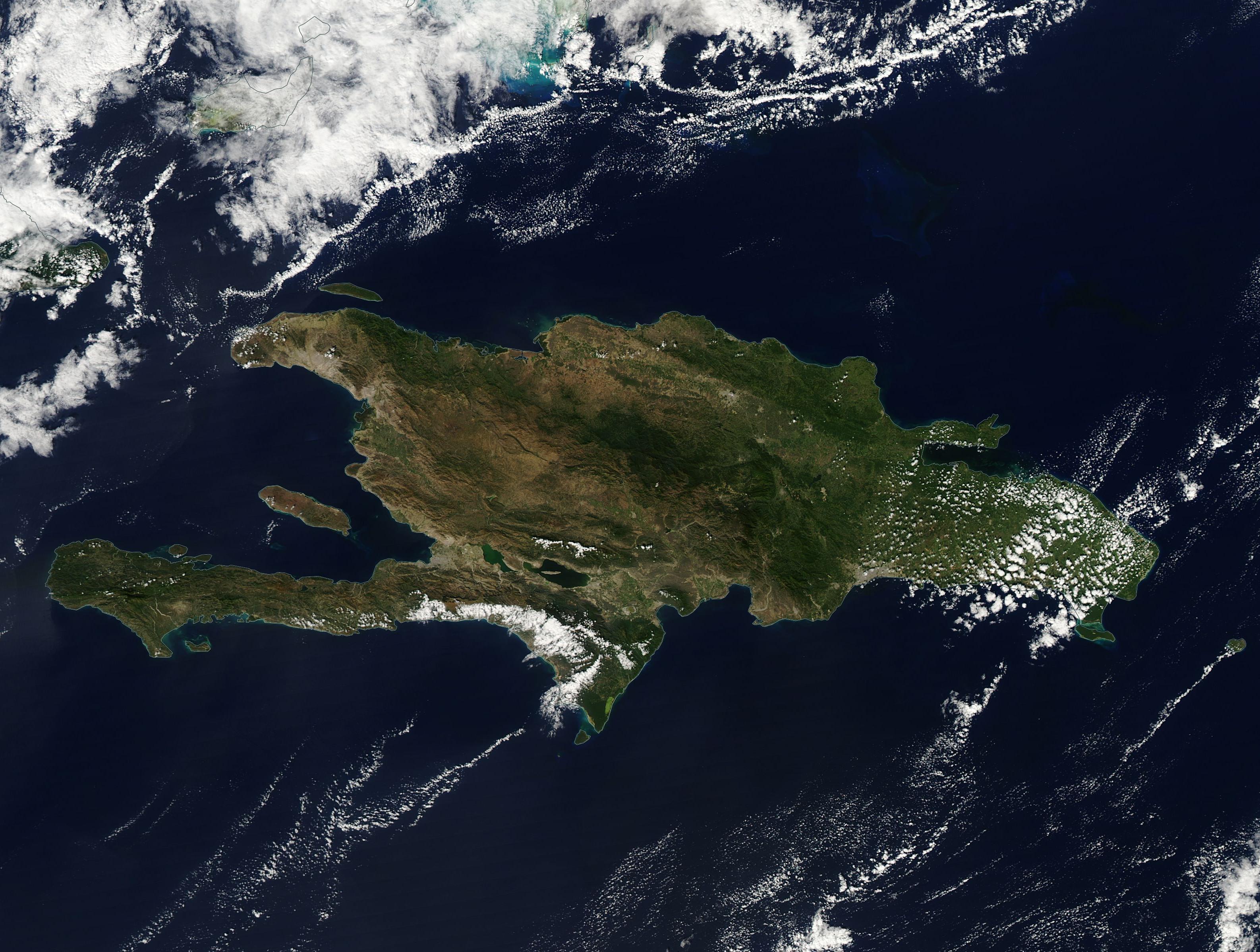
English: On January 19, 2016, the Moderate Resolution Imaging Spectroradiometer (MODIS) aboard NASA�s Aqua satellite flew over the West Indies and captured this beautiful clear-sky image of the island of Hispaniola.
The second-largest island in the Caribbean, Hispaniola is home to two countries. The Dominican Republic lies in the eastern two-thirds of the island, and Haiti occupies the western third. The terrain is rugged, with five major mountain ranges that stretch across the island, interspersed with steep and typically fertile valleys. The arrangement, height and ruggedness of the terrain makes travel from south to north difficult. The Dominican Republic is about twice the size of the state of New Hampshire, with 51.5% of the land used for agriculture, with just over 10% in permanent crops and almost 25% in permanent pasture. Forests cover about 40.8% of the Dominican Republic. Haiti is slightly smaller than the state of Maryland, with 66.4% of land in agricultural use. Permanent crops account for just over 10% of agricultural land, and permanent pasture about 17.7 %. In contrast to the Dominican Republic, Haiti�s land is only 3.6% forested. |
||
| Дата | Снято: 19 января 2016 | ||
| Источник |
Haiti and Dominican Republic (direct link)
|
||
| Автор | Jeff Schmaltz, MODIS Land Rapid Response Team, NASA GSFC |
| This media is a product of the Aqua mission Credit and attribution belongs to the mission team, if not already specified in the "author" row |
Лицензирование
| Этот файл находится в общественном достоянии (англ. public domain), так как он был создан NASA (Национальным управлением по аэронавтике и исследованию космического пространства). Политика авторского права NASA гласит, что «Материал NASA не защищается авторским правом, если не указано иное». (См. Template:PD-USGov, страницу политики авторского права NASA или политику использования изображений JPL.) | ||
 |
Предупреждения:
|
История файла
Нажмите на дату/время, чтобы посмотреть файл, который был загружен в тот момент.
| Дата/время | Миниатюра | Размеры | Участник | Примечание | |
|---|---|---|---|---|---|
| текущий | 19:46, 15 февраля 2024 | | 3172 × 2396 (972 КБ) | OptimusPrimeBot | #Spacemedia - Upload of http://modis.gsfc.nasa.gov/gallery/images/image02072016_250m.jpg via Commons:Spacemedia |
Использование файла
Нет страниц, использующих этот файл.
.jpg)