Файл:Hatteras, Outer Banks, North Carolina (14268258908).jpg

Исходный файл (4000 × 3000 пкс, размер файла: 2,04 МБ, MIME-тип: image/jpeg)
Этот файл находится на Викискладе. Сведения о нём показаны ниже.
Викисклад — централизованное хранилище для свободных файлов, используемых в проектах Викимедиа.
|
.jpg?uselang=ru)
Краткое описание
| Описание |
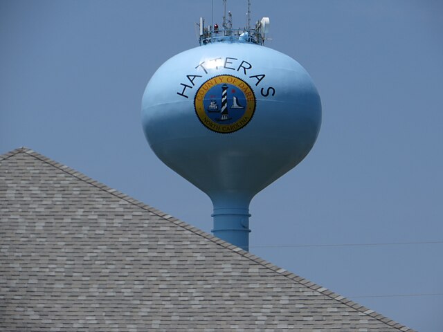
Hatteras is an unincorporated community in Dare County, North Carolina, United States, on the Outer Banks island of Hatteras. North Carolina Highway 12 passes through the community linking it to Frisco and Ocracoke (via a ferry in Hatteras). It is south of the famous Cape Hatteras and the Cape Hatteras Lighthouse in Buxton. The inlet that the ferries use is Hatteras Inlet. Hatteras is best known as a fishing and vacation destination. This community offers visitors ample opportunities for recreation, sightseeing, and remote relaxation especially on its beautiful beaches. Watersports are plentiful on both the ocean-side and the sound-side of the village. Proximity to the convergence of the Labrador Current and the Gulf Stream result in the largest surf available on the East Coast. On the protected Pamlico Sound side of the island watersports such as windsurfing, kayaking, kiteboarding, and swimming are all readily available and accessible. Fishing is a major source of recreation as well as revenue in Hatteras. In shore charters are available to fish in the Pamlico Sound. Deep sea charters are also available at Hatteras Harbor Marina and Oden's Dock. Deep sea trips take anglers to the warm waters of the Gulf Stream to fish for blue and white marlin, tuna, wahoo and mahi mahi. It takes approximately one and a half to two hours to reach the Gulf Stream from Hatteras Inlet. Pamlico Sound, which separates Hatteras and Ocracoke Islands, is one of the largest estuarine systems in the world and offers an almost limitless variety of fishing opportunities. Hatteras was named after the Hatteras Indians. Hatteras Village was cut off from the rest of the island on September 18, 2003, when Hurricane Isabel washed a 3000 feet (900 m) wide and 30 feet (9 m) deep channel called Isabel Inlet at the north end of Hatteras Village. The tear was subsequently repaired and restored by sand dredged by the Army Corps of Engineers. <a href="http://en.wikipedia.org/wiki/Hatteras,_North_Carolina" rel="nofollow">en.wikipedia.org/wiki/Hatteras,_North_Carolina</a> <a href="http://en.wikipedia.org/wiki/Wikipedia:Text_of_Creative_Commons_Attribution-ShareAlike_3.0_Unported_License" rel="nofollow">en.wikipedia.org/wiki/Wikipedia:Text_of_Creative_Commons_...</a> |
| Дата | |
| Источник | Hatteras, Outer Banks, North Carolina |
| Автор | Ken Lund from Reno, Nevada, USA |
| Местоположение камеры | | Это и другие изображения по их местоположению на OpenStreetMap |
|---|
.jpg¶ms=035.215438_N_-075.677053_E_globe:Earth_type:camera_source:Flickr_&language=ru)
Лицензирование
- Вы можете свободно:
- делиться произведением – копировать, распространять и передавать данное произведение
- создавать производные – переделывать данное произведение
- При соблюдении следующих условий:
- атрибуция – Вы должны указать авторство, предоставить ссылку на лицензию и указать, внёс ли автор какие-либо изменения. Это можно сделать любым разумным способом, но не создавая впечатление, что лицензиат поддерживает вас или использование вами данного произведения.
- распространение на тех же условиях – Если вы изменяете, преобразуете или создаёте иное произведение на основе данного, то обязаны использовать лицензию исходного произведения или лицензию, совместимую с исходной.
| Это изображение изначально опубликовано на Flickr участником проекта Ken Lund по ссылке https://flickr.com/photos/75683070@N00/14268258908. Оно было досмотрено 11 февраля 2020 роботом FlickreviewR 2, который подтвердил, что изображение лицензировано в соответствии с условиями cc-by-sa-2.0. |
История файла
Нажмите на дату/время, чтобы посмотреть файл, который был загружен в тот момент.
| Дата/время | Миниатюра | Размеры | Участник | Примечание | |
|---|---|---|---|---|---|
| текущий | 02:27, 11 февраля 2020 | | 4000 × 3000 (2,04 МБ) | Ser Amantio di Nicolao | Transferred from Flickr via #flickr2commons |
Использование файла
Нет страниц, использующих этот файл.
.jpg)