Перейти на страницу файла на Викискладе

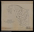
Файл:Mapa da Vila de Carapicuíba (1949).jpg

Материал из Википедии — свободной энциклопедии
Перейти к навигации Перейти к поиску

Исходный файл(3858 × 3610 пкс, размер файла: 970 КБ, MIME-тип: image/jpeg)

Краткое описание

Описание
Português: Mapa da Vila de Carapicuíba elaborado pelo Instituto Geográfico e Geológico de São Paulo no ano de elevação da Vila ao status jurídico de Distrito de Barueri. Naquele ano (1949), a Vila de Carapicuíba era composta dos bairros/loteamentos de Vila Silvânia e Vila Anita Caldas. Mapa do acervo cartográfico do Arquivo Público do Estado de São Paulo, código IGCSPBR APESP IGC IGG CAR I B 0014 001 001.
Дата
Источник

Arquivo Público do Estado de São Paulo

http://www.arquivoestado.sp.gov.br/site/acervo/repositorio_digital/documento_cartografico
Автор

Rogério de T. Campos /

Instituto Geográfico e Geológico de São Paulo - IGGSP

Лицензирование

Public domain
This work is in the public domain in Brazil for one of the following reasons:
  • It is a work published or commissioned by a Brazilian government (federal, state, or municipal) prior to 1983. (Law 3071/1916, art. 662; Law 5988/1973, art. 46; Law 9610/1998, art. 115)
  • It is the text of a treaty, convention, law, decree, regulation, judicial decision, or other official enactment. (Law 9610/1998, art. 8)
  • It is a work whose authors' rights belong to the Brazilian government (federal, state, or municipal), for which the economic rights shall be protected for a period of 70 years from the first of January of the year following that of their disclosure or that of the author's demise, whichever is later. ([1])

Deutsch  English  español  français  italiano  日本語  Nederlands  português  sicilianu  slovenščina  +/−

История файла

Нажмите на дату/время, чтобы посмотреть файл, который был загружен в тот момент.

Дата/времяМиниатюраРазмерыУчастникПримечание
текущий11:29, 16 июля 2020Миниатюра для версии от 11:29, 16 июля 20203858 × 3610 (970 КБ)Sorocabano 32Uploaded a work by Rogério de T. Campos / Instituto Geográfico e Geológico de São Paulo - IGGSP from Arquivo Público do Estado de São Paulo http://www.arquivoestado.sp.gov.br/site/acervo/repositorio_digital/documento_cartografico with UploadWizard

Нет страниц, использующих этот файл.

Глобальное использование файла

Данный файл используется в следующих вики:

  • Использование в pt.wikipedia.org

Метаданные