Файл:PIA22155 - Arsia Mons.tif

Исходный файл (1275 × 2766 пкс, размер файла: 2,19 МБ, MIME-тип: image/tiff)
Этот файл находится на Викискладе. Сведения о нём показаны ниже.
Викисклад — централизованное хранилище для свободных файлов, используемых в проектах Викимедиа.
|
Краткое описание
| Описание |
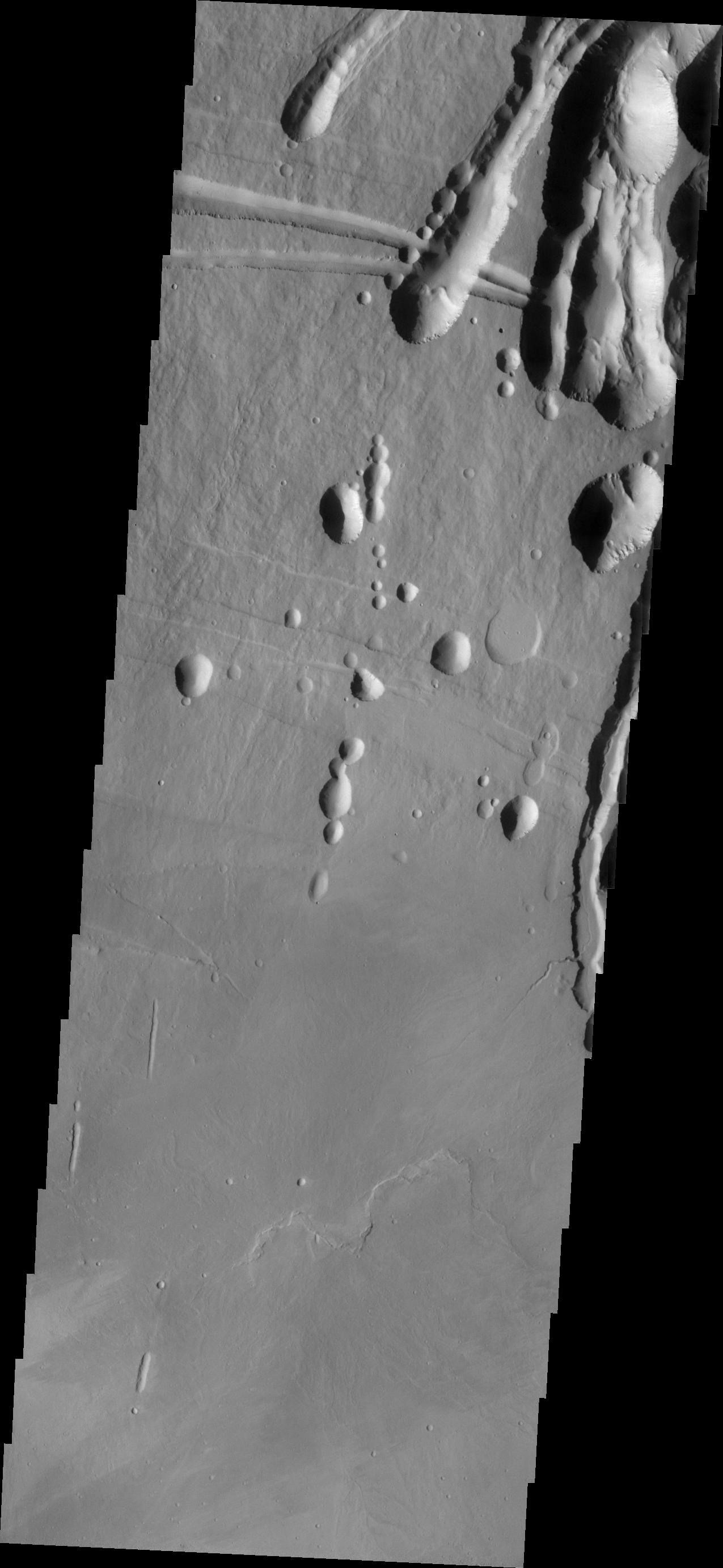
English: The three large aligned Tharsis volcanoes are Arsia Mons, Pavonis Mons and Ascraeus Mons (from south to north). There are collapse features on all three volcanoes, on the southwestern and northeastern flanks. This alignment may indicate a large fracture/vent system was responsible for the eruptions that formed all three volcanoes. The flows originating from Arsia Mons are thought to be the youngest of the region. This VIS image shows part of the northeastern flank of Arsia Mons at the summit caldera. In this region the summit caldera does not have a steep margin most likely due to renewed volcanic flows within this region of the caldera. The scalloped depressions at the top of the image are most likely created by collapse of the roof of lava tubes. Lava tubes originate during eruption event, when the margins of a flow harden around a still flowing lava stream. When an eruption ends these can become hollow tubes within the flow. With time, the roof of the tube may collapse into the empty space below. The tubes are linear, so the collapse of the roof creates a linear depression.
Arsia Mons is the southernmost of the Tharsis volcanoes. It is 270 miles (450km) in diameter, almost 12 miles (20km) high, and the summit caldera is 72 miles (120km) wide. For comparison, the largest volcano on Earth is Mauna Loa. From its base on the sea floor, Mauna Loa measures only 6.3 miles high and 75 miles in diameter. A large volcanic crater known as a caldera is located at the summit of all of the Tharsis volcanoes. These calderas are produced by massive volcanic explosions and collapse. The Arsia Mons summit caldera is larger than many volcanoes on Earth. The Odyssey spacecraft has spent over 15 years in orbit around Mars, circling the planet more than 69000 times. It holds the record for longest working spacecraft at Mars. THEMIS, the IR/VIS camera system, has collected data for the entire mission and provides images covering all seasons and lighting conditions. Over the years many features of interest have received repeated imaging, building up a suite of images covering the entire feature. From the deepest chasma to the tallest volcano, individual dunes inside craters and dune fields that encircle the north pole, channels carved by water and lava, and a variety of other feature, THEMIS has imaged them all. For the next several months the image of the day will focus on the Tharsis volcanoes, the various chasmata of Valles Marineris, and the major dunes fields. We hope you enjoy these images! Orbit Number: 17716 Latitude: -8.11179 Longitude: 240.245 Instrument: VIS Captured: 2005-12-12 00:29 Please see the THEMIS Data Citation Note for details on crediting THEMIS images. NASA's Jet Propulsion Laboratory manages the 2001 Mars Odyssey mission for NASA's Science Mission Directorate, Washington, D.C. The Thermal Emission Imaging System (THEMIS) was developed by Arizona State University, Tempe, in collaboration with Raytheon Santa Barbara Remote Sensing. The THEMIS investigation is led by Dr. Philip Christensen at Arizona State University. Lockheed Martin Astronautics, Denver, is the prime contractor for the Odyssey project, and developed and built the orbiter. Mission operations are conducted jointly from Lockheed Martin and from JPL, a division of the California Institute of Technology in Pasadena. |
| Дата | (published 2018-01-01) |
| Источник | Catalog page · Full-res (JPEG · TIFF) |
| Автор | NASA/JPL-Caltech/ASU |
| Место на Марсе | Это и другие изображения по их местоположению на Картах Google |
|---|
Это изображение или видеозапись внесены в каталог Лаборатории реактивного движения НАСА под идентификатором (Photo ID): PIA22155. Этот шаблон не указывает на правовой статус данной работы. По-прежнему необходим нормальный шаблон лицензий. См. Commons:Лицензирование. Другие языки:
|
| This media is a product of the 2001 Mars Odyssey mission Credit and attribution belongs to the Thermal Emission Imaging System (THEMIS) team, NASA/JPL-Caltech/ASU |
Лицензирование
| Этот файл находится в общественном достоянии (англ. public domain), так как он был создан NASA (Национальным управлением по аэронавтике и исследованию космического пространства). Политика авторского права NASA гласит, что «Материал NASA не защищается авторским правом, если не указано иное». (См. Template:PD-USGov, страницу политики авторского права NASA или политику использования изображений JPL.) | ||
 |
Предупреждения:
|
История файла
Нажмите на дату/время, чтобы посмотреть файл, который был загружен в тот момент.
| Дата/время | Миниатюра | Размеры | Участник | Примечание | |
|---|---|---|---|---|---|
| текущий | 22:30, 20 января 2018 |  | 1275 × 2766 (2,19 МБ) | Jarnsax | =={{int:filedesc}}== {{NASA Photojournal | catalog = PIA22155 | image = yes | mission = 2001 Mars Odyssey | instrument = Thermal Emission Imaging System | caption = {{en|The three large aligned {{w|Tharsis}} volcanoes are {... |
Использование файла
Нет страниц, использующих этот файл.