Файл:Rafah (FL165866638 5062341).jpg
Перейти к навигации
Перейти к поиску

Размер этого предпросмотра: 621 × 600 пкс. Другие разрешения: 248 × 240 пкс | 497 × 480 пкс | 795 × 768 пкс | 1060 × 1024 пкс | 2120 × 2048 пкс | 15 606 × 15 074 пкс.
Исходный файл (15 606 × 15 074 пкс, размер файла: 247,39 МБ, MIME-тип: image/jpeg)
Этот файл находится на Викискладе. Сведения о нём показаны ниже.
Викисклад — централизованное хранилище для свободных файлов, используемых в проектах Викимедиа.
|
Краткое описание
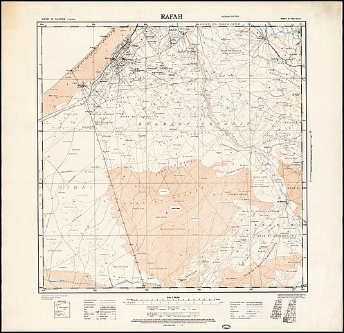
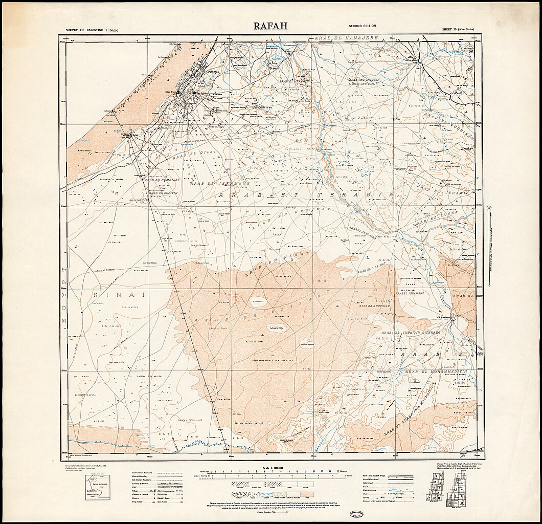
| Rafah
( |
||||||||||||||||||||||||
|---|---|---|---|---|---|---|---|---|---|---|---|---|---|---|---|---|---|---|---|---|---|---|---|---|
| Название |
Rafah |
|||||||||||||||||||||||
| Издательство |
War office |
|||||||||||||||||||||||
| Описание |
Rafah.. |
|||||||||||||||||||||||
| Язык | английский язык | |||||||||||||||||||||||
| Дата публикации | 1941 | |||||||||||||||||||||||
| Техника | 1 sheet : color ; | |||||||||||||||||||||||
| Размеры | 63 × 66 см | |||||||||||||||||||||||
| Хранится в коллекции |
|
|||||||||||||||||||||||
| Текущее местонахождение |
|
|||||||||||||||||||||||
| Место издания | unknown | |||||||||||||||||||||||
| search Merhav catalog | unknown | |||||||||||||||||||||||
| Примечания |
Compiled from a map by Dept. of Lands & Surveys, Palestine, 1935, with road revision to 1939. Heliographed at O.S. and printed by W.O, 1941.; Geographical Section, General Staff, No. 4079.; Published at the War Office 1940. Second ed., 1941. English: Palestine. 1:100,000 New Series ; 10 | |||||||||||||||||||||||
| масштаб | 1:100,000 cm | |||||||||||||||||||||||
| IE PID | IE165866636 | |||||||||||||||||||||||
| Rosetta имя файла | FL165866638 | |||||||||||||||||||||||
| код записи в NNL (P3959) | 990050623410205171 | |||||||||||||||||||||||
| search Merhav catalog | английский язык | |||||||||||||||||||||||
| search Merhav catalog | War office | |||||||||||||||||||||||
| Источник/Фотограф |
|
|||||||||||||||||||||||
| Другие версии | ||||||||||||||||||||||||
| Jpg / Tif version |
|
|||||||||||||||||||||||

.jpg)

.jpg?uselang=ru)
Лицензирование
This UK artistic or literary work, of which the author is unknown and cannot be ascertained by reasonable enquiry, is in the public domain because it is one of the following:
|
 |
История файла
Нажмите на дату/время, чтобы посмотреть файл, который был загружен в тот момент.
| Дата/время | Миниатюра | Размеры | Участник | Примечание | |
|---|---|---|---|---|---|
| текущий | 15:31, 2 сентября 2023 | | 15 606 × 15 074 (247,39 МБ) | Geagea | pattypan 22.03 |
Использование файла
Нет страниц, использующих этот файл.
.jpg)