Файл:Snow in the Southeastern United States (MODIS 2022-01-20).jpg
Перейти к навигации
Перейти к поиску
Размер этого предпросмотра: 737 × 599 пкс. Другие разрешения: 295 × 240 пкс | 590 × 480 пкс | 944 × 768 пкс | 1259 × 1024 пкс | 2518 × 2048 пкс | 3760 × 3058 пкс.
Исходный файл (3760 × 3058 пкс, размер файла: 1,46 МБ, MIME-тип: image/jpeg)
Этот файл находится на Викискладе. Сведения о нём показаны ниже.
Викисклад — централизованное хранилище для свободных файлов, используемых в проектах Викимедиа.
|
.jpg?uselang=ru)
Краткое описание
| Описание |
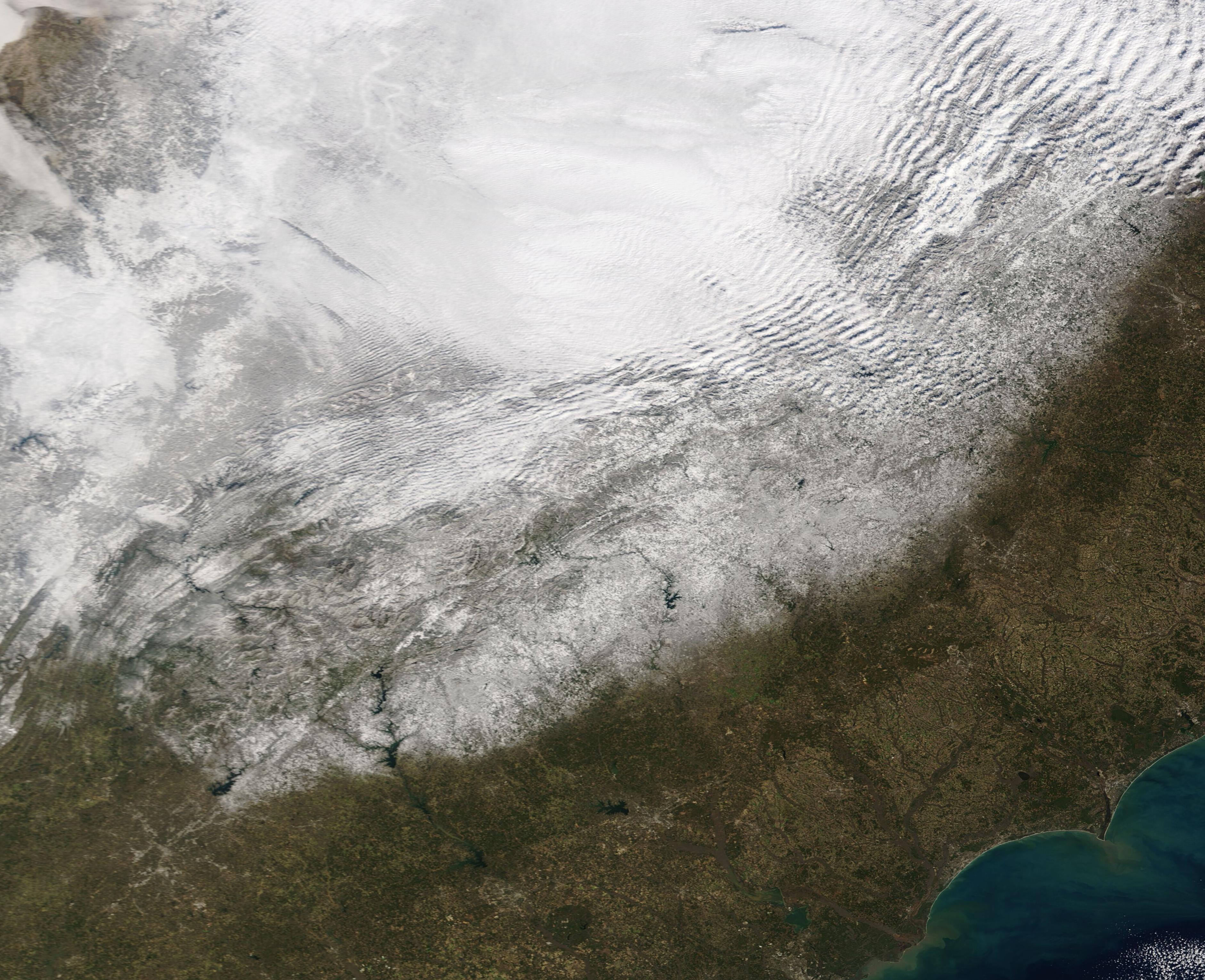
English: A strong “Saskatchewan Screamer” whipped up wicked weather across much of the United States in mid-January 2022, leaving a swath of snow and wind damage in its wake. The fast-moving low-pressure system developed over Saskatchewan, Canada then dropped below the border on January 13, bringing up to 12 inches of snow in northern North Dakota and western Minnesota. Des Moines, Iowa was buried under a whopping 14.3 inches of snow as the stormed screamed southward, bringing heavy snow to parts of Missouri, Arkansas, Tennessee—and tornadoes to Florida—before pivoting northeastward to roar across the Mid-Atlantic and Northeast. According to The Weather Channel, the heaviest snow totals from the January 13-17 storm fell in northeast Ohio, northwest Pennsylvania, and western New York. They report 27 inches of snow in Ashtabula, Ohio and 23.4 inches near Kenmore New York.
The Moderate Resolution Imaging Spectroradiometer (MODIS) on board NASA’s Terra satellite acquired a true-color image of a swath of snow painted by the robust winter storm. The band of visible snow is centered on the I-95 corridor, starting just north of Atlanta, Georgia and covered parts of Georgia, South Carolina, Tennessee, North Carolina and Virginia. Heavy cloud hangs over Kentucky, West Virginia, Ohio, and western Maryland. A “Saskatchewan Screamer” is a nickname for a fast-moving low-pressure system that sweeps southeast out of the Canadian province of Saskatchewan, typically carrying snow, strong winds, and cold air along with it. If a similar system develops to the west, over the province of Alberta, it is known as an Alberta Clipper. Move the origin to the east, and it can be called a Manitoba Mauler. |
||
| Дата | Снято: 18 января 2022 | ||
| Источник |
Snow in the Southeastern United States (direct link)
|
||
| Автор | MODIS Land Rapid Response Team, NASA GSFC |
| This media is a product of the Terra mission Credit and attribution belongs to the mission team, if not already specified in the "author" row |
Лицензирование
| Этот файл находится в общественном достоянии (англ. public domain), так как он был создан NASA (Национальным управлением по аэронавтике и исследованию космического пространства). Политика авторского права NASA гласит, что «Материал NASA не защищается авторским правом, если не указано иное». (См. Template:PD-USGov, страницу политики авторского права NASA или политику использования изображений JPL.) | ||
 |
Предупреждения:
|
История файла
Нажмите на дату/время, чтобы посмотреть файл, который был загружен в тот момент.
| Дата/время | Миниатюра | Размеры | Участник | Примечание | |
|---|---|---|---|---|---|
| текущий | 22:20, 9 января 2024 | | 3760 × 3058 (1,46 МБ) | OptimusPrimeBot | #Spacemedia - Upload of http://modis.gsfc.nasa.gov/gallery/images/image01202022_250m.jpg via Commons:Spacemedia |
Использование файла
Нет страниц, использующих этот файл.
.jpg)