Файл:Southeastern United States (MODIS 2020-05-05).jpg
Перейти к навигации
Перейти к поиску

Размер этого предпросмотра: 665 × 600 пкс. Другие разрешения: 266 × 240 пкс | 532 × 480 пкс | 852 × 768 пкс | 1136 × 1024 пкс | 2271 × 2048 пкс | 6641 × 5989 пкс.
Исходный файл (6641 × 5989 пкс, размер файла: 4,25 МБ, MIME-тип: image/jpeg)
Этот файл находится на Викискладе. Сведения о нём показаны ниже.
Викисклад — централизованное хранилище для свободных файлов, используемых в проектах Викимедиа.
|
.jpg?uselang=ru)
Краткое описание
| Описание |
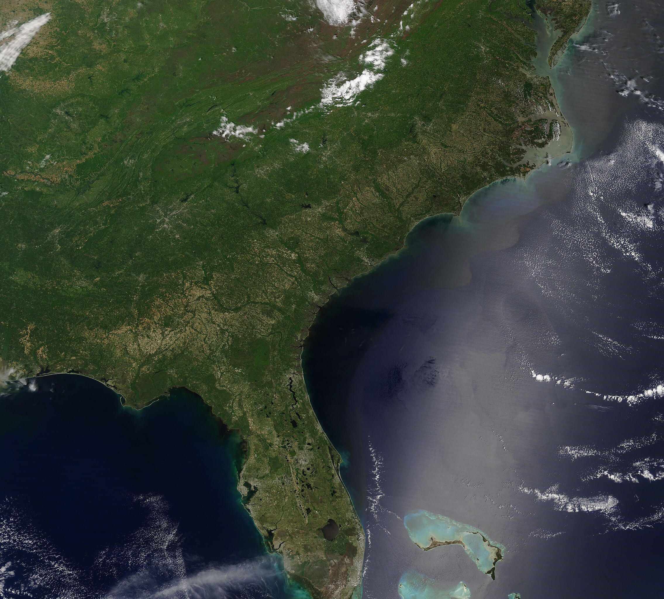
English: On May 2, 2020, the Moderate Resolution Imaging Spectroradiometer (MODIS) on board the Terra satellite acquired a true-color image that gave a sweeping view of springtime across the Southeastern United States.
Cloud hangs over part of the Appalachian Mountains, which stretch approximately 1,500 miles (2,400 km) from Newfoundland, Canada to Alabama, United States. Although a relatively low mountain chain, the Appalachians are one of the oldest mountains chains in the world. The rocks that form these mountains are estimated to be 540 to 300 million years old. The Blue Ridge Mountains are the eastern-most section of the greater Appalachians. The Cumberland Plateau sits west of the Appalachians, rising more than 1,000 feet across eastern Tennessee, Alabama, and north into Kentucky. Once a remote virgin forest built on rock-strewn ridges and steep green ravines, this area marks one of the world’s longest expanse of hardwood-forested plateau. East of the Blue Ridge Mountains the rolling Piedmont region stretches to the lowlands of the Coastal Plain. The Coastal Plain is a rich agricultural region, so it’s no surprise that much of it appears tan as fields and croplands are renewed at the start of a new growing season. |
||
| Дата | Снято: 2 мая 2020 | ||
| Источник |
Southeastern United States (direct link)
|
||
| Автор | MODIS Land Rapid Response Team, NASA GSFC |
| This media is a product of the Terra mission Credit and attribution belongs to the mission team, if not already specified in the "author" row |
Лицензирование
| Этот файл находится в общественном достоянии (англ. public domain), так как он был создан NASA (Национальным управлением по аэронавтике и исследованию космического пространства). Политика авторского права NASA гласит, что «Материал NASA не защищается авторским правом, если не указано иное». (См. Template:PD-USGov, страницу политики авторского права NASA или политику использования изображений JPL.) | ||
 |
Предупреждения:
|
История файла
Нажмите на дату/время, чтобы посмотреть файл, который был загружен в тот момент.
| Дата/время | Миниатюра | Размеры | Участник | Примечание | |
|---|---|---|---|---|---|
| текущий | 03:07, 17 февраля 2024 | | 6641 × 5989 (4,25 МБ) | OptimusPrimeBot | #Spacemedia - Upload of http://modis.gsfc.nasa.gov/gallery/images/image05052020_250m.jpg via Commons:Spacemedia |
Использование файла
Нет страниц, использующих этот файл.
.jpg)