Файл:Xingu Indigenous Park in Mato Grasso (MODIS 2020-07-13).jpg

Исходный файл (2435 × 1947 пкс, размер файла: 574 КБ, MIME-тип: image/jpeg)
Этот файл находится на Викискладе. Сведения о нём показаны ниже.
Викисклад — централизованное хранилище для свободных файлов, используемых в проектах Викимедиа.
|
.jpg?uselang=ru)
Краткое описание
| Описание |
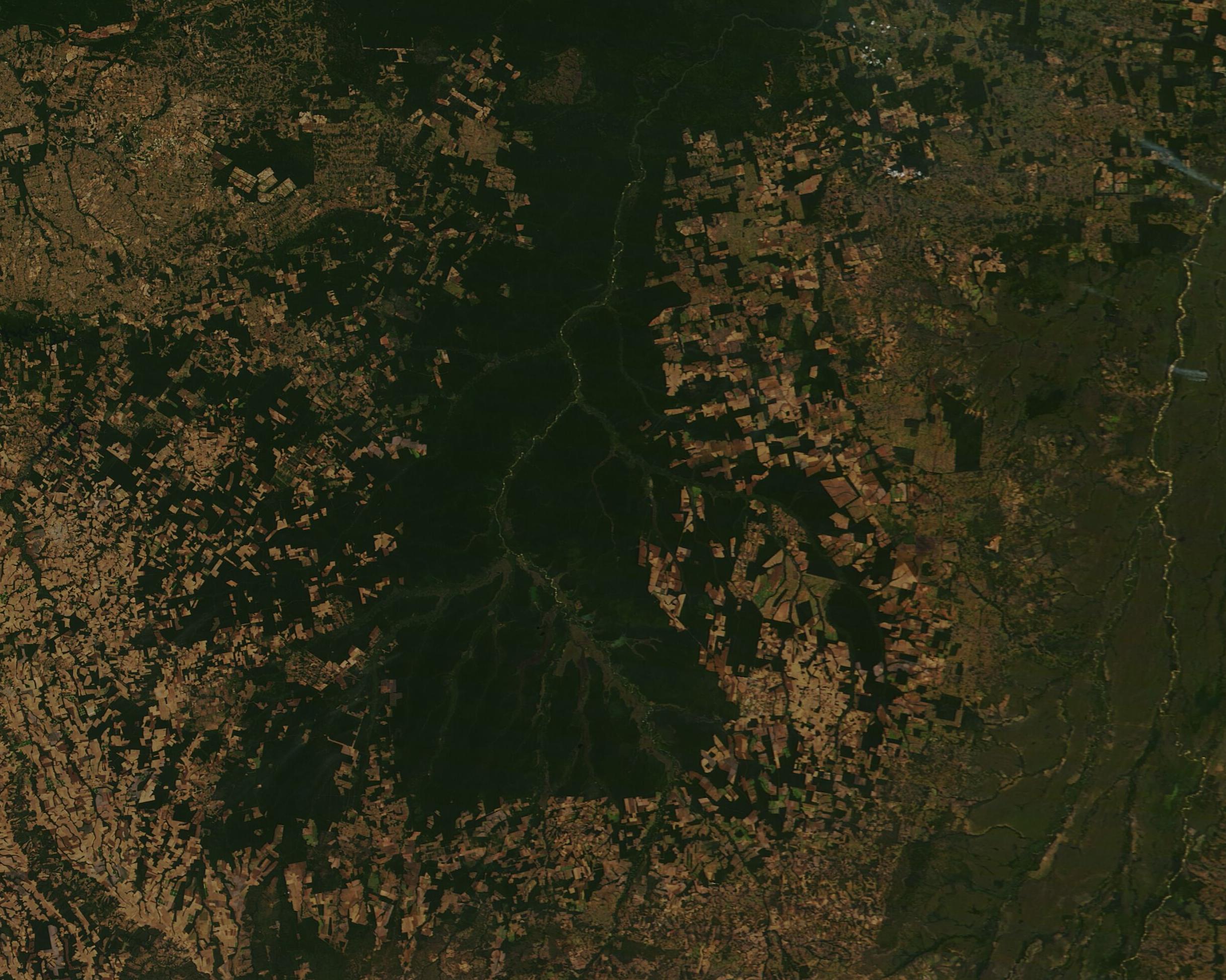
English: A green ecological enclave, rich in biodiversity and cultural diversity, sits in the northeastern section of Mato Grosso state in Brazil. Spanning about 6.5 million acres (2.64 million hectares) the Xingu Indigenous Park has been set aside to preserve the traditional life and lands of people who traditionally survived closely allied with the ecosystems of the Amazon Rainforest. To protect the indigenous tribes as well as preserve biodiversity, the park was set aside in the early 1960s.
While the park was created to minimize the impact of disturbance of outside forces on the Xingu peoples, which include about 14 indigenous groups and more than 4,000 individuals who call this forest native homeland, the protection has not always been perfect. By the 1980s, hunters and fishermen began to use the park and soon encroaching cattle ranching and agricultural industries whittled away at park boundaries, putting pressure on the remaining forestlands. While the boundaries have been better clarified, agricultural activity and outside the park has virtually eliminated other local rainforest, putting substantial pressure on the Xingu Indigenous Park, including the migration of animals through the park, which has been reduced due to lack of outside habitat, and pollution to the headwaters of the central waterway, the Xingu River. Oh July 9, 2020, the Moderate Resolution Imaging Spectroradiometer (MODIS) on board NASA’s Terra satellite acquired a true-color image of Xingu Indigenous Park. The branching Xingu River can be seen surrounded by dark green rainforest. The deep green forest almost appears to dangle like a pendulum into an area distinguished by the tan-and-green patchwork of heavily deforested land currently used primarily for agriculture. A few small areas of forest still remain outside of the park. |
||
| Дата | Снято: 9 июля 2020 | ||
| Источник |
Xingu Indigenous Park in Mato Grasso (direct link)
|
||
| Автор | MODIS Land Rapid Response Team, NASA GSFC |
| This media is a product of the Terra mission Credit and attribution belongs to the mission team, if not already specified in the "author" row |
Лицензирование
| Этот файл находится в общественном достоянии (англ. public domain), так как он был создан NASA (Национальным управлением по аэронавтике и исследованию космического пространства). Политика авторского права NASA гласит, что «Материал NASA не защищается авторским правом, если не указано иное». (См. Template:PD-USGov, страницу политики авторского права NASA или политику использования изображений JPL.) | ||
 |
Предупреждения:
|
История файла
Нажмите на дату/время, чтобы посмотреть файл, который был загружен в тот момент.
| Дата/время | Миниатюра | Размеры | Участник | Примечание | |
|---|---|---|---|---|---|
| текущий | 02:58, 17 февраля 2024 | | 2435 × 1947 (574 КБ) | OptimusPrimeBot | #Spacemedia - Upload of http://modis.gsfc.nasa.gov/gallery/images/image07132020_250m.jpg via Commons:Spacemedia |
Использование файла
Нет страниц, использующих этот файл.
.jpg)