Файл:Custer Battlefield marked on the 1851 De Smet map of the Indian territories as defined in the Fort Laramie treaty (1851).png
Перейти к навигации
Перейти к поиску

Размер этого предпросмотра: 800 × 536 пкс. Другие разрешения: 320 × 214 пкс | 640 × 429 пкс | 1024 × 686 пкс | 1280 × 857 пкс | 2560 × 1714 пкс | 4255 × 2849 пкс.
Исходный файл (4255 × 2849 пкс, размер файла: 15,64 МБ, MIME-тип: image/png)
Этот файл находится на Викискладе. Сведения о нём показаны ниже.
Викисклад — централизованное хранилище для свободных файлов, используемых в проектах Викимедиа.
|
.png?uselang=ru)
Краткое описание
| Описание |
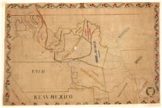
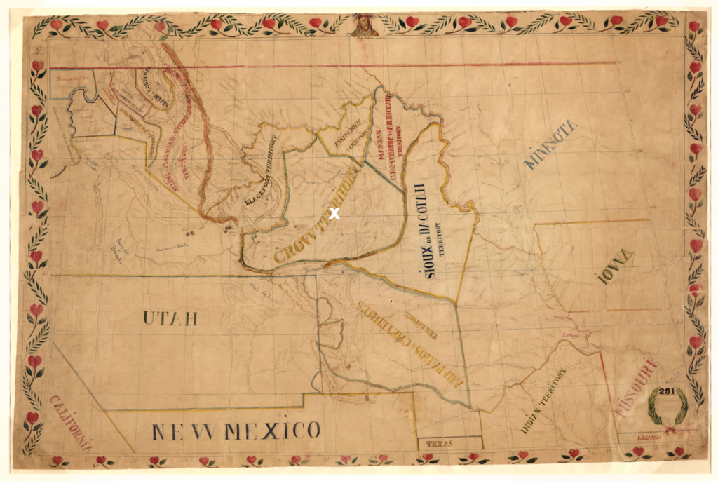
Dansk: De Smets forvrængede kort over de forskellige præriestammers territorier som fastlagt i 1851 med Fort Laramie traktaten. Custer slaget ved Little Bighorn River i 1876 mellem lakotaer og den amerikanske hær er markeret med hvidt. Kampen fandt sted i hjertet af et område anerkendt af lakotaerne som deres fjender i crow-stammens territorium i 1851
English: De Smets twisted map of the territories of the plains tribes as agreed upon in the Fort Laramie treaty (1851). The white X marks the Custer Battlefield at the Little Bighorn River (1876) between the Lakotas and the U.S. Army in the heart of a territory recognized by the Lakota as the land of their enemies in the Crow Nation in 1851 |
| Дата | |
| Источник | Library of Congress. hdl.loc.gov/loc.gmd/g4050.ct000883. “Map of the Upper Great Plains and Rocky Mountains region.” (The map is adapted to show the Custer Battlefield in Crow treaty defined territory (Fort Laramie Treaty 1851)) |
| Автор | Father De Smet (1801-1873). |
Лицензирование
Это произведение находится в общественном достоянии (англ. public domain) в США, так как оно было опубликовано до 1 января 1929 года.
Чтобы быть размещёнными на Викискладе, произведения в общественном достоянии не должны быть защищены авторским правом одновременно и в США, и в стране-источнике данного произведения. Если произведение опубликовано не в США, файл должен иметь дополнительный шаблон лицензии, показывающий его статус в стране-источнике с точки зрения охраны авторских прав.
|

|
This is a file uploaded through the Danish Wikipedia, which has not been reviewed on Commons:
|
История файла
Нажмите на дату/время, чтобы посмотреть файл, который был загружен в тот момент.
| Дата/время | Миниатюра | Размеры | Участник | Примечание | |
|---|---|---|---|---|---|
| текущий | 09:07, 18 сентября 2022 | | 4255 × 2849 (15,64 МБ) | Indianertosset | Uploaded a work by Father De Smet (1801-1873). from Library of Congress. hdl.loc.gov/loc.gmd/g4050.ct000883. “Map of the Upper Great Plains and Rocky Mountains region.” (The map is adapted to show the Custer Battlefield in Crow treaty defined territory (Fort Laramie Treaty 1851)) with UploadWizard |
Использование файла
Нет страниц, использующих этот файл.
Глобальное использование файла
Данный файл используется в следующих вики:
- Использование в da.wikipedia.org
.png)