Файл:Flounce Rock (16272433739).jpg
Исходный файл (1920 × 1080 пкс, размер файла: 2,59 МБ, MIME-тип: image/jpeg)
Этот файл находится на Викискладе. Сведения о нём показаны ниже.
Викисклад — централизованное хранилище для свободных файлов, используемых в проектах Викимедиа.
|
.jpg?uselang=ru)
Краткое описание
| Описание |
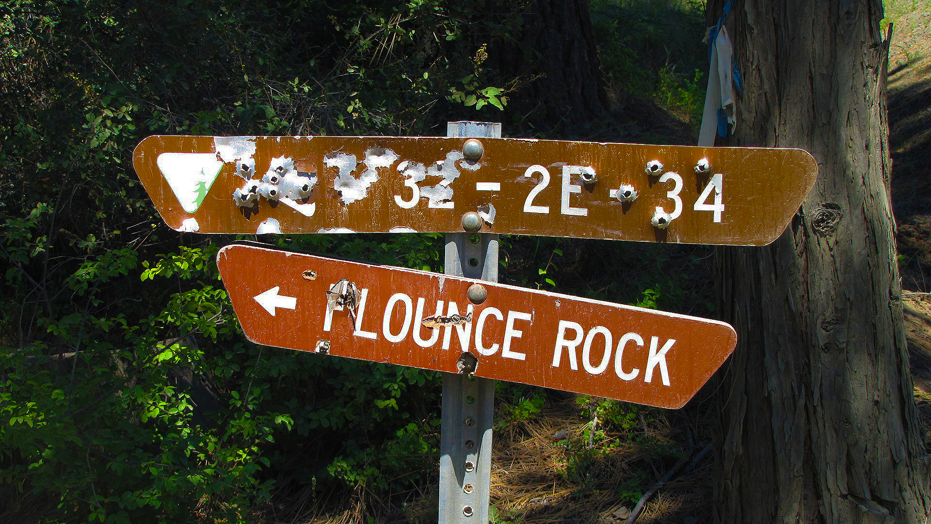
For a birdseye view of the Upper Rogue area, drive the winding gravel road up to the top of Flounce Rock. Just short of the top, take a 5 minute walk out to a rare population of Baker Cypress. Those with higher clearance vehicles can drive the final one-third mile to the top, and park at the microwave towers. A short, unmaintained trail to the south provides an unobstructed view of Lost Creek Lake, the Rogue River valley, and the Cascades. From Medford: Travel north on Highway 62 through the town of Shady Cove, and past Lost Creek Lake. After crossing the bridge over the Rogue River, continue 2.5 miles and turn left on Ulrich Road, located near milemarker 38. Travel another 2.5 miles to a "Y" junction, and take the left fork onto BLM Road 32-2E-34. Travel 4.2 miles to a wide parking area. The trail to a small population of Bakers Cypress is through the rail fence on the left. Vehicles with high clearance can travel another 1/3 mile up to the top of Flounce. Note: After leaving Highway 62, the first mile is through a residential neighborhood - please drive slowly to keep the dust down. This route is a narrow, steep, winding road not recommended for vehicles pulling trailers. Access is weather dependent, and is not accessible during winter. To learn more about this spectacular area head on over to: <a href="http://blm.gov/65ld" rel="nofollow">blm.gov/65ld</a> |
| Дата | |
| Источник | Flounce Rock |
| Автор | Bureau of Land Management Oregon and Washington from Portland, America |
Лицензирование
- Вы можете свободно:
- делиться произведением – копировать, распространять и передавать данное произведение
- создавать производные – переделывать данное произведение
- При соблюдении следующих условий:
- атрибуция – Вы должны указать авторство, предоставить ссылку на лицензию и указать, внёс ли автор какие-либо изменения. Это можно сделать любым разумным способом, но не создавая впечатление, что лицензиат поддерживает вас или использование вами данного произведения.
| Это изображение изначально опубликовано на Flickr участником проекта BLMOregon по ссылке https://flickr.com/photos/50169152@N06/16272433739. Оно было досмотрено 13 мая 2018 роботом FlickreviewR 2, который подтвердил, что изображение лицензировано в соответствии с условиями cc-by-2.0. |
| This image is a work of a Bureau of Land Management* employee, taken or made as part of that person's official duties. As a work of the U.S. federal government, the image is in the public domain in the United States. *or predecessor organization |
USGov files uploaded by OceanAtoll
История файла
Нажмите на дату/время, чтобы посмотреть файл, который был загружен в тот момент.
| Дата/время | Миниатюра | Размеры | Участник | Примечание | |
|---|---|---|---|---|---|
| текущий | 13:31, 13 мая 2018 | | 1920 × 1080 (2,59 МБ) | OceanAtoll | Transferred from Flickr via #flickr2commons |
Использование файла
Нет страниц, использующих этот файл.
.jpg)