Файл:Horseshoe bend map.jpg
Перейти к навигации
Перейти к поиску
Размер этого предпросмотра: 671 × 600 пкс. Другие разрешения: 269 × 240 пкс | 537 × 480 пкс | 859 × 768 пкс | 1244 × 1112 пкс.
Исходный файл (1244 × 1112 пкс, размер файла: 231 КБ, MIME-тип: image/jpeg)
Этот файл находится на Викискладе. Сведения о нём показаны ниже.
Викисклад — централизованное хранилище для свободных файлов, используемых в проектах Викимедиа.
|
Краткое описание
| Описание |
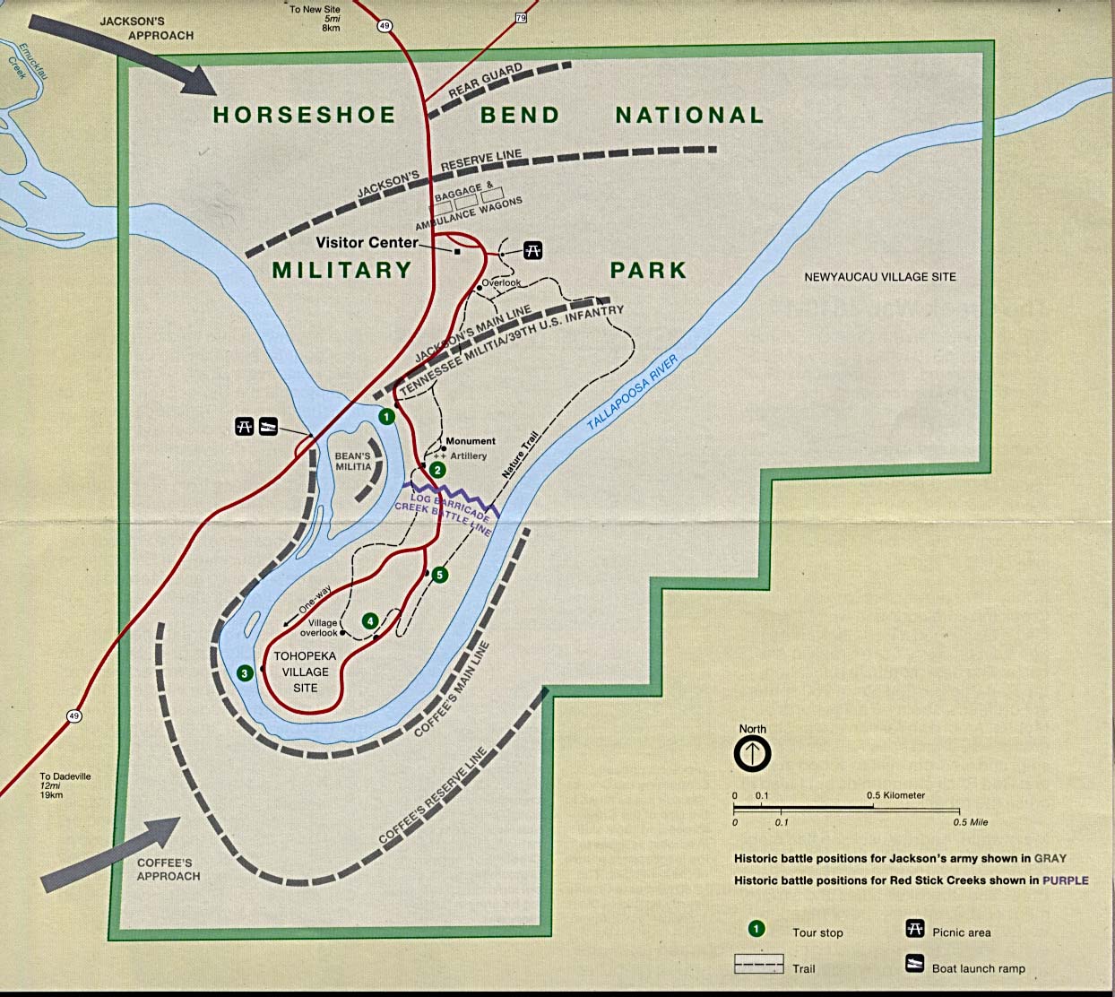
English: This image is held in the PCL Map Collection at the University of Texas Libraries, The University of Texas at Austin. (Copyrighted material in this collection is clearly marked.) The map shows the Horseshoe Bend National Military Park and is annotated with the historical battle positions of Jackson's Army and the Creek Red Sticks. |
| Дата | 1 августа 2005 (дата первоначальной загрузки файла на вики) |
| Источник | Перенесено с en.wikipedia на Викисклад. Retrieved from here |
| Автор | "Courtesy of the University of Texas Libraries, The University of Texas at Austin." |
Лицензирование
See online license
| Автор этого произведения, PCL Map Collection at the University of Texas Libraries, передаёт его в общественное достояние. Это разрешение действует по всему миру. В некоторых странах это не может быть возможно юридически, в таком случае: PCL Map Collection at the University of Texas Libraries предоставляет любому право использовать данное произведение в любых целях, без каких-либо условий, если только такие условия не требуются по закону.
|
Исходный журнал загрузок
Первоначальная страница описания находилась здесь. Все нижеперечисленные имена участников относятся к en.wikipedia.
- 2005-08-01 20:12 Vern Reisenleiter 1244×1112× (236405 bytes) This image is held in the PCL Map Collection at the University of Texas Libraries, The University of Texas at Austin. (Copyrighted material in this collection is clearly marked.) The map shows the Horseshoe Bend National Miltary Park and is annotat
История файла
Нажмите на дату/время, чтобы посмотреть файл, который был загружен в тот момент.
| Дата/время | Миниатюра | Размеры | Участник | Примечание | |
|---|---|---|---|---|---|
| текущий | 15:59, 23 июня 2014 | | 1244 × 1112 (231 КБ) | Jalo | Transferred from en.wikipedia |
Использование файла
Следующая страница использует этот файл:
Глобальное использование файла
Данный файл используется в следующих вики:
- Использование в ca.wikipedia.org
- Использование в en.wikipedia.org
- Использование в en.wikivoyage.org
- Использование в it.wikipedia.org