Файл:NASA Wallops Flight Facility, 2010.jpg
Исходный файл (1024 × 683 пкс, размер файла: 557 Кб, MIME-тип: image/jpeg)
Этот файл находится на Викискладе. Сведения о нём показаны ниже.
Викисклад — централизованное хранилище для свободных файлов, используемых в проектах Викимедиа.
|
Краткое описание
| Описание |
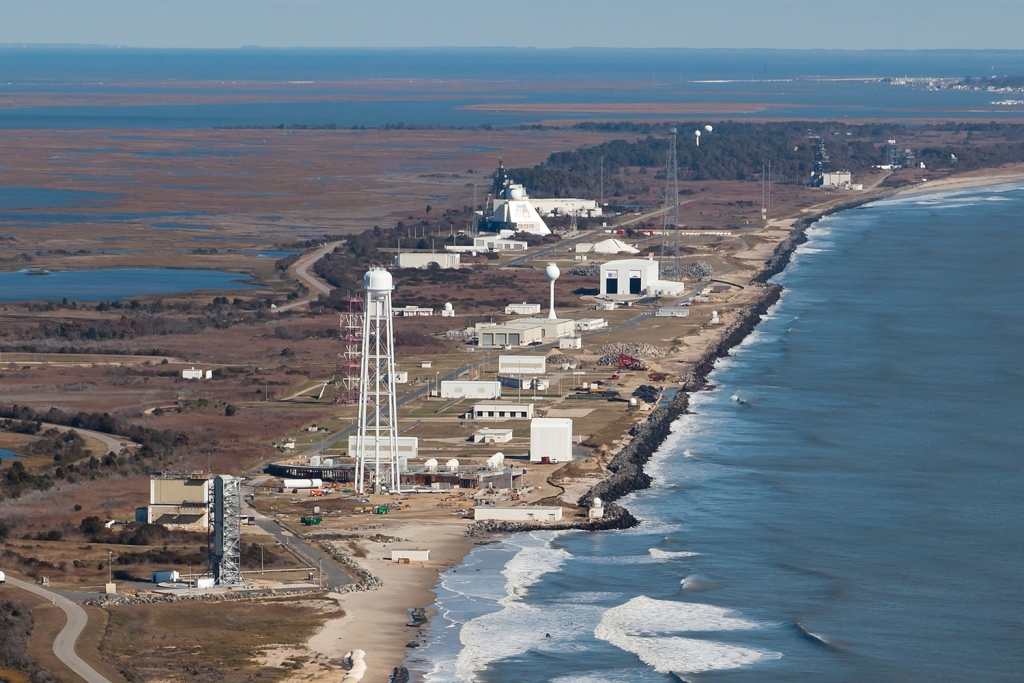
English: NASA Goddard Space Flight Center's Wallops Flight Facility, located on Virginia's Eastern Shore, was established in 1945 by the National Advisory Committee for Aeronautics, as a center for aeronautic research.
Wallops is now NASA's principal facility for management and implementation of suborbital research programs. The Wallops Mission Plan includes the following objectives: • To help achieve NASA's strategic objectives for scientific and educational excellence through cost efficient integration, launch, and operations of suborbital and small orbital payloads. • To enable scientific, educational, and economic advancement by providing the facilities and expertise to enable frequent flight opportunities for a diverse customer base. • To serve as a key facility for operational test, integration, and certification of NASA and commercial next-generation, low-cost orbital launch technologies. • To pioneer productive and innovative government, industry, and academic partnerships. The research and responsibilities of Wallops Flight Facility are centered around the philosophy of providing a fast, low cost, highly flexible and safe response to meet the needs of the United States' aerospace technology interests and science research. The 1,000 full-time Civil Service and contractor NASA Wallops employees act as a team to accomplish our mission in the spirit of this philosophy. NASA also opens its unique facilities to industry for space and aeronautics research. Wallops expects an increase in commercial launch activity in the very near future. |
| Дата | |
| Источник | NASA Wallops Flight Facility |
| Автор | NASA/Wallops Flight Facility |
| Местоположение камеры | | Это и другие изображения по их местоположению на OpenStreetMap |
|---|
Лицензирование
| Этот файл находится в общественном достоянии (англ. public domain), так как он был создан NASA (Национальным управлением по аэронавтике и исследованию космического пространства). Политика авторского права NASA гласит, что «Материал NASA не защищается авторским правом, если не указано иное». (См. Template:PD-USGov, страницу политики авторского права NASA или политику использования изображений JPL.) | ||
 |
Предупреждения:
|
История файла
Нажмите на дату/время, чтобы посмотреть файл, который был загружен в тот момент.
| Дата/время | Миниатюра | Размеры | Участник | Примечание | |
|---|---|---|---|---|---|
| текущий | 20:41, 31 августа 2011 | | 1024 × 683 (557 Кб) | File Upload Bot (Magnus Manske) | {{Information |Description=NASA Goddard Space Flight Center's Wallops Flight Facility, located on Virginia's Eastern Shore, was established in 1945 by the National Advisory Committee for Aeronautics, as a center for aeronautic research. Wallops is now N |
Использование файла
Следующая страница использует этот файл:
Глобальное использование файла
Данный файл используется в следующих вики:
- Использование в ca.wikipedia.org
- Использование в ceb.wikipedia.org
- Использование в en.wikipedia.org
- Использование в eo.wikipedia.org
- Использование в fa.wikipedia.org
- Использование в fi.wikipedia.org
- Использование в gl.wikipedia.org
- Использование в he.wikipedia.org
- Использование в it.wikipedia.org
- Использование в ja.wikipedia.org
- Использование в pt.wikipedia.org
- Использование в sk.wikipedia.org
- Использование в uk.wikipedia.org
- Использование в www.wikidata.org