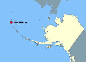
Файл:AmchitkaAlaskaLoc.png
Перейти к навигации
Перейти к поиску
AmchitkaAlaskaLoc.png (300 × 219 пкс, размер файла: 14 Кб, MIME-тип: image/png)
История файла
Нажмите на дату/время, чтобы посмотреть файл, который был загружен в тот момент.
| Дата/время | Миниатюра | Размеры | Участник | Примечание | |
|---|---|---|---|---|---|
| текущий | 21:20, 2 августа 2007 |  | 300 × 219 (14 Кб) | Adam~commonswiki | {{Information |Description=This map is a derivative work of a map layer from nationalatlas.gov, which states: "We have begun by collaboratively building "frameworks," the essential map layers that provide a foundation for all other maps. These basic layer |
Использование файла
Следующая страница использует этот файл:
Глобальное использование файла
Данный файл используется в следующих вики:
- Использование в ar.wikipedia.org
- Использование в az.wikipedia.org
- Использование в cs.wikipedia.org
- Использование в en.wikipedia.org
- Использование в eo.wikipedia.org
- Использование в es.wikipedia.org
- Использование в fr.wikipedia.org
- Использование в gl.wikipedia.org
- Использование в ha.wikipedia.org
- Использование в hu.wikipedia.org
- Использование в ig.wikipedia.org
- Использование в rm.wikipedia.org
- Использование в ro.wikipedia.org
- Использование в uk.wikipedia.org
- Использование в vi.wikipedia.org
- Использование в zh.wikipedia.org

